


Weather Telematics Data
Overview
Description
Weather Telematics is a smart mobility company founded in 2010 that operates a proprietary mobile sensor network. The mobile network consists of a fleet of Con-way commercial trucks and buses, referred to as mobile platforms. Atmospheric data, such as temperature, pressure, relative humidity, precipitation, ozone, dewpoint and light level are collected by meteorological instrumentation optimately placed on the mobile platforms. MADIS has been collecting Weather Telematics data or originally referred to as MoPED data since 2010, operationally since February 2013. Weather Telematics data was not available from December 2016 to January 2017, data has resumed since February 2017.
Geographic Coverage
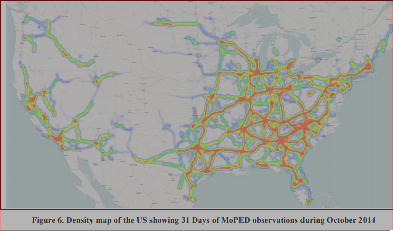
As shown in the figure below, the geographic coverage is on a CONUS scale with the highest concentration of mobile platforms operating in the mid to eastern part of the U.S.
Data Schedule
Weather Telematics data comes from SYNOPTIC every 5 minutes and includes 1 minute reports for most all vehicles, however, the data will have periods of no reports due to maintenance and routing schedules of the vehicles.
Volume
The typical monthly volume has been up to 32,000,000 observations from about 800-1000 vehicles. Please click here for volume from all MADIS datasets.
Restrictions
The Weather Telematics dataset is restricted as a level 4 or NOAA only. Please click here to learn more about data restricitions.
Variable Details
- List of variables
- Quality Control Processing and Data Structures
Related Links
Last updated 24 May 2017