


MADIS Data - 0000 UTC 12 Sep 2005
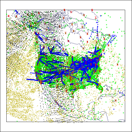
MADIS data available at 0000 UTC 12 September 2005. Blue circles indicate aircraft-based reports; green crosses indicate surface observations; brown dots indicate satellite wind reports, black dots indicate satellite soundings and radiances, and the letters "X" (red), "P" (orange), and "R" (dark green) indicate radiosonde, profiler, and radiometer locations, respectively.
Last updated 16 March 2017