


MADIS is a meteorological observational database and data delivery system that provides
observations that cover the globe.
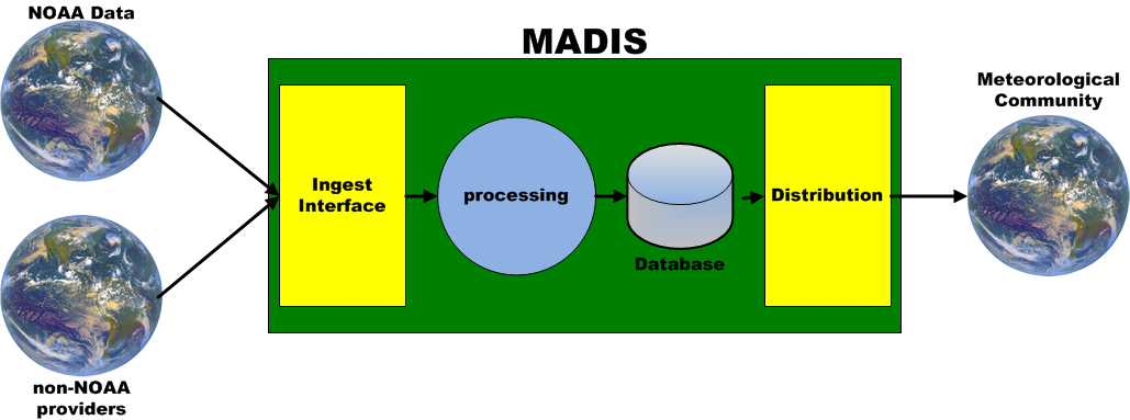
MADIS ingests data from NOAA data sources and non-NOAA providers, decodes the data then encodes all of the observational data into a common format with uniform observational units and time stamps. Quality checks are conducted and the integrated data sets are stored along with a series of flags indicating the results of the various QC checks. MADIS provides several methods for users to access the data to meet their needs. Users can request data from July of 2001, which is when MADIS was first available to the public, to the present.
To provide these services, MADIS leverages partnerships with international agencies; federal, state, and local agencies (e.g., states' Departments of Transportation); universities; volunteer networks; and the private sector (e.g., airlines, railroads) to integrate and quality check observations from their stations with those of NOAA.
MADIS runs operationally at the NWS National Centers for Environmental Prediction (NCEP) Central Operations (NCO) as part of the Integrated Dissemination Project (IDP). All MADIS data is being added to NOAA's data archive that is run by the National Environmental Satellite, Data, and Information Service (NESDIS) National Climatic Data Center (NCDC).
All questions should be sent to MADIS Support.
Last updated 27 February 2022