


Satellite Sounding Dataset
Overview
Description
The MADIS satellite sounding dataset consists of multiple products from different "providers" that are integrated into a single dataset. Currently, these products consist of temperature and moisture soundings from the NOAA Polar Orbital Environmental Satellites (POES). The POES system offers the advantage of daily global coverage, by making nearly polar orbits roughly 14.1 times daily. Since the number of orbits per day is not an integer the suborbital tracks do not repeat on a daily basis, although the local solar time of each satellite's passage is essentially unchanged for any latitude. NOAA maintains a four satellite configuration (morning NOAA-15 primary, NOAA-17 secondary, and afternoon -- NOAA-19 primary, NOAA-16 and NOAA-18 secondary)*, allowing NOAA to obtain data five times daily in any one location. The soundings are produced by the ATOVS (Advanced TIROS Operational Vertical Sounder) instrument package. It is composed of the Advanced Microwave Sounding Units A and B (AMSU-A, AMSU-B) and is complemented by the High Resolution Infrared Radiation Sounder (HIRS/3). For the NOAA N-N' satellite series, starting with NOAA-18, the AMSU-B sounder has been replaced by the Microwave Humidity Sounder (MHS), and the infrared sounder has been upgraded to HIRS/4. The AMSU-A is a multi-channel microwave radiometer that will be used for measuring global atmospheric temperature profiles under clear and cloudy conditions. AMSU-A measures in 15 spectral bands, where the temperature sounding mainly exploits the oxygen band at 50 GHz.
The MHS is the follow-on instrument for the Advanced Microwave Sounding Unit-B (AMSU-B) flying as a part of ATOVS on the NOAA-N satellites. MHS is a 5 channel microwave radiometer, which complements the Advanced Microwave Sounding Unit-A (AMSU-A) channels. It is planned to derive from these frequencies humidity profiles, cloud liquid water content and precipitation. Additionally, its sensitivity to large water droplets in precipitating clouds can provide a qualitative estimate of precipitation rates. It is technically similar to the AMSU-B instrument, except for channel 5, where the AMSU-B side-band at 176.31 GHz is missing. The HIRS/4 instrument is an infrared sounder that measures the incident radiation primarily in the infrared region of the spectrum in 19 channels. It also has one channel in the visible. Its purpose is to measure temperature and water vapour profiles under clear-sky conditions.
*Due to a failed AMSU-A instrument, MADIS doesn't carry data from NOAA-17, and due to a failed HIRS-3 instrument NOAA-15 is also not included.
MADIS has been collecting Satellite Sounding data since October 2005.
Geographic Coverage
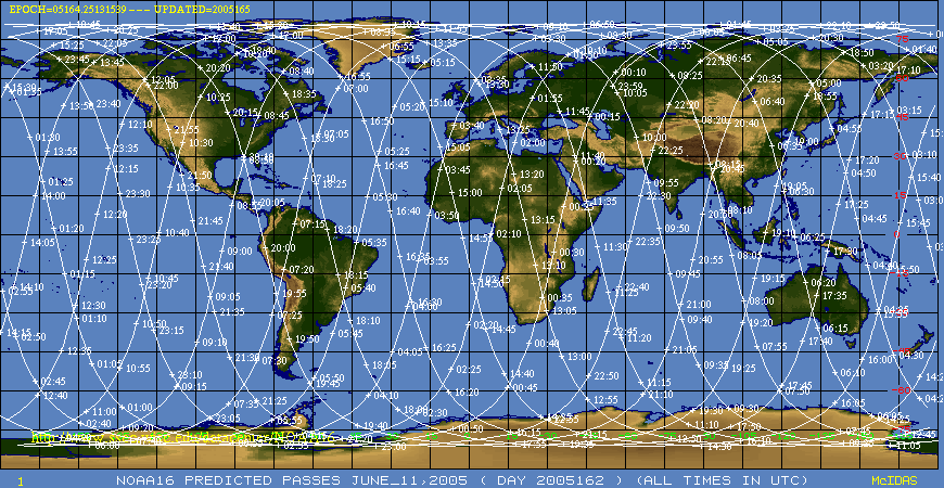
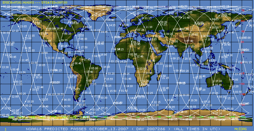
The coverage is global (see first paragraph above). There are approximately 340,000 soundings are available per day. Here are graphics showing typical orbits for NOAA-16, and NOAA-18.
Data Schedule
Newly arriving data are binned into hourly files, and between 3 and 10 files are produced (or updated) every 15 minutes or so. Because of the variance in the schedule, ldm is the preferred communications method. Ftp users should download data at minutes 13, 28, 43 and 58. Each download should get 10 files ranging from one hour back to 10 hours back. For example, at 13:15 you should get the 0300, 0400, ..., 1200 files.
Volume
Typical daily volume for all MADIS datasets can be seen here.
Restrictions
No restrictions. All observations are publicly accessible.
Variable Details
Related Links
Last updated 16 March 2017